Hiking
Print this out to take with you AreaInfo/Directions
Directions from SRO store to local hiking trails, fishing areas, swimming areas; To grocery & drug stores, hospital. Most restaurants are in Luray and on 211 East and West.
HIKING TRAILS In area–all directions are from the Outfitters Store–6502 S. Page Valley Rd:
- To the River from Outfitters
1/2 mile maintained trail–go behind Outfitters to campground, take first right driveway. Cross under white bar, follow old road bed to path on bluff. Bear right side & follow path to river. Can be muddy in the bottom. If you want to make a large circle hike–follow river Up to the #8 boat landing, then up to the main road, then back to the Outfitters(adds 1 mile). - Habron Gap Trail–blue blaze trail
Turn right out of Outfitters, go about 1 mile to boat landing at bottom of large hill(Foster’s). Park there. Walk north on road about 25 feet. Blue blaze trail on left. It goes up to a plateau/ridge–about 2 miles one way. - Indian Grave Hill Trail
Turn right out of Outfitters, go 2 miles Rt 684. At fork, go left on Rt 717. Follow to top of Indian Grave Hill(about 2 miles). Park at turn off on left. Follow trail up mountain, about 2 miles one way. - Massanutten Trail to Kennedy’s Peak
Turn left out of Outfitters. Go back to Bridge (6 miles). Don’t cross Bridge. Follow Rt 675 W as it turns up the mountain. At the top, park on the left. Trail is to the right. It a wide relatively flat trail until the last part as it goes around Kennedy’s Peak to the platform. About 3 hr round trip. - Lions Trail
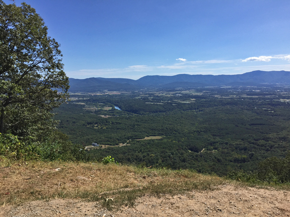
Follow above directions but continue to the bottom of mountain. Turn left on Crisman Hollow Road. Go about 1 mile to parking area/Lions trail on right. Good for small children.From there, continue by car on about 3 miles to Story Brook on left. Short hike to overlook. Continue on road to Rt 211. Turn left to go back to Luray. - Many trails in the Shenandoah National Park
Go back to Luray and east on Rt 211 to Park entrance.
Fishing in area:
Public boat landings: #8 (closest) Turn left out of Outfitters, take 2nd dirt road to left to boat landing.(1/2 mile)
#11 Turn right out of Outfitters, go about 3/4 mile to bottom of Foster’s Hill. Boat landing on right.
#13 Continue pass #11 to fork in road–take right fork (River Water Road) to end 1 mile. Camping is permitted on right before boat landing.
#1–go left out of Outfitters 6 miles back to Bridge, park in boat landing, can walk on low water bridge to fish.
National Forest Lake–National Forest stamp required–Go left out of Outfitters, take first dirt road to left 1/4 mile.
Fishing licenses can be purchased a Wal-mart: go left out of Outfitters, cross Bridge, go 3 miles, turn right on Airport Rd. Follow to stop sign. Turn left Rt 211 to Walmart on left.
Camping-primitive–on River in National Forest–AT #8 and #13(see above) Must camp outside of boat landing/parking area.
Another campsite–turn right out of Outfitters, go about 1/2 mile to ‘Private Lane’ on left. Follow to dead end-National Forest. Be careful with fires at all these areas.
Swimming:
Local–#13 boat landing–go right out of Outfitters, go 2 miles to fork. Take right on River Water Rd, go 1 mile to boat landing. Nice flat sandy area. Wear shoes in river. Don’t block boat landing.
Lake Arrowhead: swimming lake, fishing, picnic area–open dawn to dusk, Charge for swimming. Go left out of Outfitters, go to Bridge, cross Bridge(Rt 675), follow to stop sign. ( Rt 340) At Rt 340, go right to stop sign, turn left (Main St.) go to next stoplight. Turn right-Fairview Rd. Follow signs app. 3 miles to Lake Arrowhead on left.
Hawksbill Rec area-Schuler’s Pool–Stanley. Follow directions to Rt 340 (above). Turn right on RT 340 S. At light, go straight for 7 miles. At Hawksbill Diner, turn left, go to stop sign, turn right, go about 1/2 mile, turn right on RT 626 to Hawksbill rec center & pool on left.
Children activities:
Luray Zoo–go left out of Outfitters, go to Bridge, cross Bridge(Rt 675), go about 3 miles, turn right Airport Rd. Go to stop sign, turn left on R 211.Go about 1 mile. on right, across from Food Lion.
The Maze at Luray Caverns–just past Luray Zoo, on left at Luray Caverns
Rope Course at Luray Cavern
The Imagination Station Playground and ball fields-follow signs to Luray High School and then signs to Playground and new Skate Park. Also Skate Park in Stanley.
Grocery stores: Go left out of Outfitters, go to Bridge, cross Bridge,(Rt 675), go about 3 miles, turn right Airport Rd. Go to stop sign, turn left on Rt 211. Food Lion on left, then Walmart with groceries on left after Food Lion. Another grocery (Shopper’s Food) is on east end of Luray. Take Bus. 211 through Luray thru 2 stop lights. Grocery in shopping center on right. Willow Grove Farm Market is on 340 Bus South of Luray 1/4 mile. Massanutten Farm market is on 211 west about 3 miles (before the river and Cooter’s).
Drug Stores–CVS beside Food Lion and inside Walmart. (see above)
Hospital--go left out of Outfitters, go to Bridge, cross Bridge(Rt 675). Go about 4 miles, turn right Lee St., at stop sign, turn right Main St, turn next left at stoplight, follow road around to top of hill to hospital on left Phone Number 743-4561
Theaters-Movie-New Page Theaters-33 E Main Luray. 743-4444; B B & T Center for the Performing Arts–1 E Main Luray–live entertainment most Sat’s; Plaza on Main St Luray–Friday night music in Summer; several restaurants have live music.
Check the Luray Page County Chamber of Commerce website for current events and happenings http://www.visitluraypage.com.
Print this out hike-fish-camp info
Download the SRO Gazette
Info you can take with you!
Shenandoah River Outfitters, Inc.
Camp OutBack &
Shenandoah Canoe Company
River Log Cabins Rentals
6502 S Page Valley Road
Luray VA 22835
800-6CANOE2 (800-622-6632)
or 540-743-4159
canoes@shenandoahriver.com