

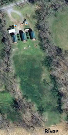
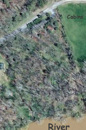
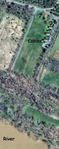
Goggle Earth Map Overview of the 3 sets of River log cabins–showing relationship to road and the Shenandoah River. These are not to the same scale. Google Earth seems to have taken these in the early Spring with the River at about 10 ft-flood.
Here is the Bigger Picture!
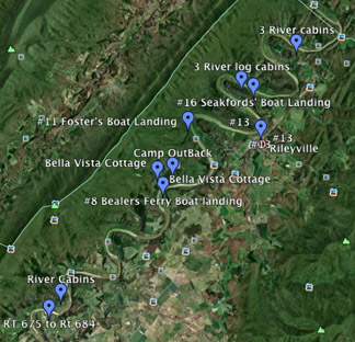
Form bottom left–Marker 1 = RT 675 Bridge, ie #1
The Bridge is 3 1/2 miles from Luray. Hook, Line and Sinker cabins are 1 1/2 mi from the Bridge.–2nd Marker Bealer’s Ferry #8–Marker 4 Shenandoah River Outfitters and Camp OutBack are 7.5 miles from the Bridge.–Marker 5 Foster’s Boat Landing-#11–Marker 5 Good’s Landing-#13–Marker 6 ; Wood Duck, Blue Heron and Osprey cabins are 10 1/2 miles from the Bridge;–Marker 7 Seakfords Landing-#16–Marker 8 #19–Marker 9 Angler, Drifter and Paddler & T=the River Lure cabins are 17 1/2 miles from the Bridge.–Marker 10
Road deadends 3/4 miles after cabins.
 Map from Luray to SRO